The Big Prairie Desert:
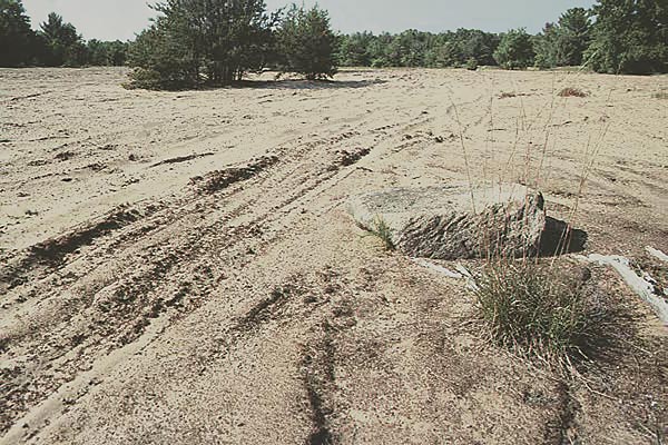
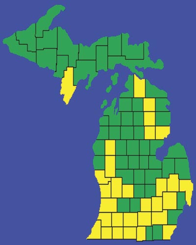
Although the Mississippi River is considered the eastern boundary of the great plains, there were prairie lands east of that boundary. Prairies in the great plains states are considered shortgrass prairies and those found in states east of the Mississippi River are considered tallgrass prairies. Prairies found between these two areas are called mixed grass prairies. Before settlement, prairie lands were found as far east as Wisconsin, Illinois, Indiana, and even Michigan. Each of these states had their prairie regions. These areas have the geography, soil, and climate that favor the prairie habitat. In Michigan's lower peninsula, there are two regions favorable for the prairie habitat. One of these regions runs from the southwest lower peninsula up to the west-central lower peninsula. Another region runs from the southeast lower peninsula into the thumb. Some western Michigan counties that had prairie lands are Cass, St. Joseph, Branch, Hillsdale, Kalamazoo, Allegan, and Newaygo counties. Along with prairies, there were even little "deserts" in Michigan that were in Allegan and Newaygo counties. The Big Prairie Desert in Newaygo County was once said to be the largest desert east of the Mississippi River. Of course, because a desert is an area receiving less than 10 inches of rainfall per year and this region of Michigan has an average yearly precipitation of 30-36 inches, there could not be a desert there. Michigan counties (in yellow) that once had prairie lands.
In truth, this "desert" was once a tallgrass prairie called the Big Prairie and was a unique feature of the State of Michigan. It extended across the top of a glacially deposited, sandy outwash plain. On its eastern end is an ancient lake bed that had probably been the deep end of a shallow glacial lake that covered the whole prairie area. After years of natural succession, the shallow lake would begin to dry up and become replaced by grasses that preferred the sandy soil. By the middle of the 19th century, when the first settlers arrived, the large shallow lake had become a pond in an open grassy plain surrounded by old-growth oak and pine trees.
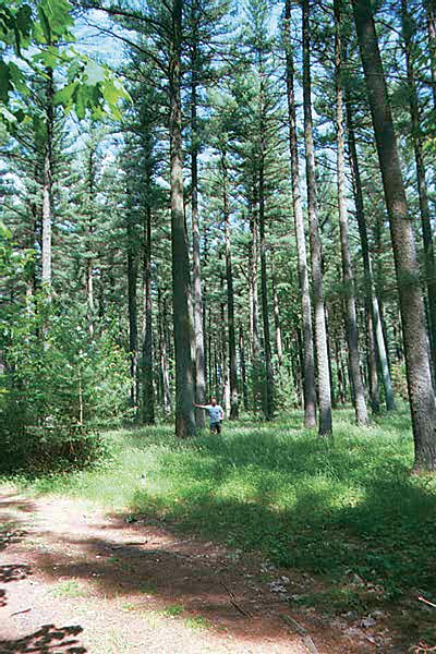
Sailor's Virgin Pines is an old growth white pine forest near the Muskegon river and former prairie areas.
Along with the Big Prairie were other prairies of various sizes in the region. The whole southeast section of Newaygo County was once a complex of four treeless prairies surrounded by oak-pine barrens. Use Acrobat Reader to view this PDF map of Newaygo in the early years. The four major prairies were known as the Big Prairie, the Marengo Prairie, the Surrerar Prairie, and the Little Prairie (which was also known as Stern's Prairie and Mitchell's Prairie). An oak-pine barren, also known as an oak savanna, is a mostly open plain containing white pine, white oak, and prairie grasses. These oak barrens were three to four times larger than the treeless prairies they surrounded and contained only around 8 trees per acre. The combined size of the Big Prairie and the oak-pine barrens surrounding it made the whole Big Prairie area around ten square miles. The pioneers made no distinction between oak barrens and treeless prairies and very often referred to the unspoiled tallgrass prairies as "deserts".
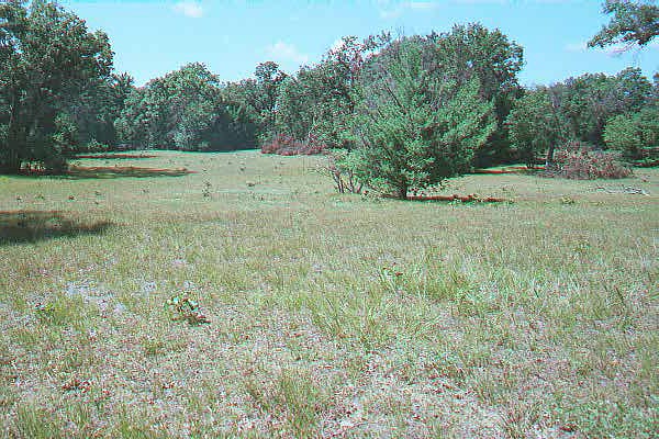
This is an undisturbed remnant of an oak-pine barren known as the Ore-Ida Prairie
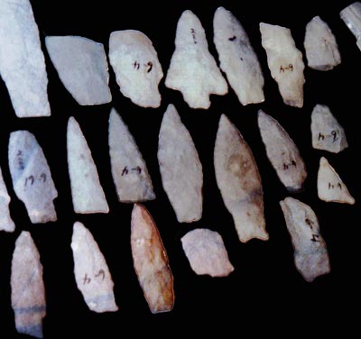
In the time before the Indian Removal Act, Native Americans had undoubtedly hunted the Big Prairie. Numerous arrowheads found there gives evidence that the prairie was once a hunting ground. Although most permanent Native American villages were in the extreme southern part of the state, Native Americans used the northern portion of the state as seasonal hunting and fishing grounds. While prairies and oak barrens were prone to wildfires, the Big Prairie was probably maintained by occasionally burning, a practice often used on the prairie-woodland habitat by Native Americans.
Collection of flint points found in Michigan.
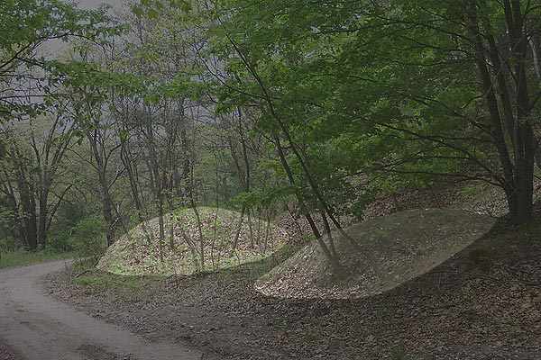
One Native American group to occupy the area was the Illinois Hopewell culture. The Hopewell culture is best known for its mound-building practices in the states south of Michigan. Sometime between 400 BC and 500 AD, the Hopewell built at least two villages and many burial mounds near the edges of the prairies. In more recent history, from the 1600s up to the 1830s, the area was occupied by the Ottawa, Pottawatomie, and Chippewa tribes. The Chippewa were the most recent tribe to have villages in the area and Newaygo County itself is thought to be named after a Chippewa chief (the meaning of the word 'Newaygo' is disputed by historians).
Click Here to read Part 2 "The Big Prairie Desert: Michigan's Dustdowl" Click Here to Return to the Big Prairie Desert Home Page
|
